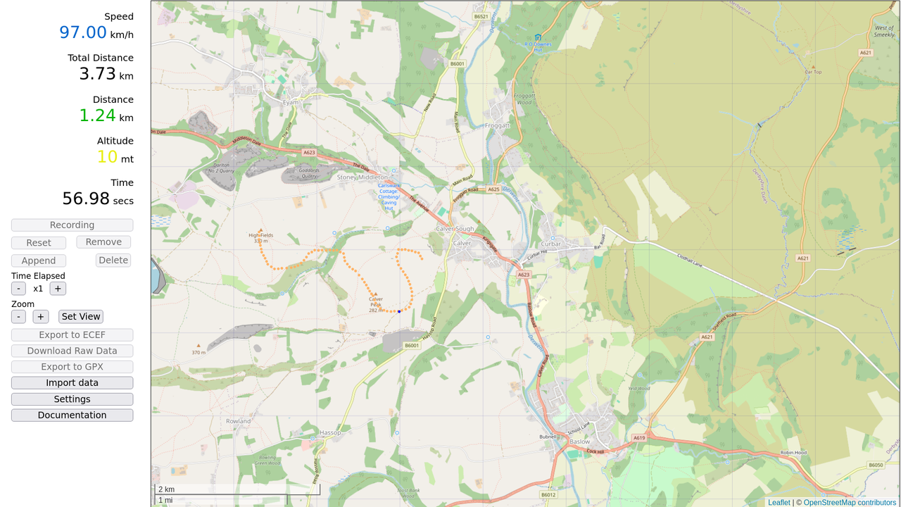
This is an application that generates ECEF coordinates from a drawn path on a map. The data generated can be used to generate GPS signal files for applications that simulate GPS signal gps-sdr-sim.
- ONE file application
- Export as csv containing ECEF coordinates.
- Download the raw data of the drawn path containing speed and altitude.
- Download the drawn path as gpx file.
-
Download ECEF path generator.
-
Open it with your internet browser.
-
Click Settings, input the desire latitude and longitude where the map will be centered. Also the colours for the trail and mover can be customized.
-
Over the map, draw a path using the mouse while pressing the left button, if it is needed you can delete the last points drawn with the button Remove.
-
Adjust the initial speed:
- key W increment speed by 5km and Q decrement it by 5km,
- key S increment speed by 2km and A decrement it by 2km,
- key X increment speed by 1km and Z decrement it by 1km,
- right arrow increment speed by 0.5km and left arrow decrement it by 0.5km,
-
Adjust the altitude with up arrow (increment) and down arrow (decrement), altitued is in meters.
-
Adjust the initial time elapsed. At x1 this means that the mover will take 15 seconds on a 1 kilometre path at 240 km/hr, at x2 it will take 7.5 (of real time), at x4 3.75 sec (of real time) and so on. This will not affect the recording.
-
Click "Recorder / Player", click Record, a blue point will start moving along the drawn path. You can modify the speed as you wish.
-
After finishes the recording, you can see the result by pressing the Play button.
-
Zoom can be adjusted at any time.
-
Center the map to any point clicked on the map.
-
Recorder / Player
- Record starts to record the position and speed of the mover. Once the recording has finished, speed can not be change. However it can be reset.
- Reset reset the path ready to be recorded again from the beginning. Speed is override.
- Delete delete the current path.
- Remove as far as the path has not been recorded, clicking remove will remove the last point of the path, click it as needed to remove the many point.
- Append allows to add more points to the path. After recording a path, you can add more points to it by clicking Reset.
-
More Actions
- Set View clicking this button will allow you to center the map on the location selected by clicking on the map with the mouse's left button. Click it again to draw a path.
- Settings here you can set the latitude, longitude, altitude, zoom and colour for the path and mover.
- Export to ECEF after recording, you can download the path in ECEF coordinates, you will need to input the frequency in Hertz for the sample data. To use with gps-sdr-sim the sampling rate of the user motion has to be 10Hz.
- Download Raw Data this allows you to download the raw data a path was recorded, so you can import it later to play it, reset and change the speed and generate a different ECEF coordinate file.
- Download GPX export the path as gpx. The gpx format is widely supported by various GPS devices and software, making it a standard choice for outdoor enthusiasts and professionals.
The main objective of this application is to generate ECEF coordinates for gps simulators that use that kind of data. However we can export the raw data as a basic gpx file.