




3dtiles-inspector is a Node.js package and CLI for opening a local 3D Tiles tileset in a browser inspector, adjusting the root transform, tuning geometric-error scaling, cropping supported 3D Gaussian Splat tilesets, and saving the result back to disk.
Requires Node.js 18 or newer.
This project is based on and integrates work from:
npm install 3dtiles-inspector3dtiles-inspector <tileset_json>npx 3dtiles-inspector <tileset_json>From a cloned repository:
npm run cli -- <tileset_json>The CLI starts a localhost HTTP server, copies the built inspector assets into a temporary directory, opens the default browser, and keeps running until you stop it with Ctrl+C.
<tileset_json> can be either:
- the root tileset JSON file, for example
out_tiles/tileset.json - a directory that contains
tileset.json
const { runInspector } = require('3dtiles-inspector');

(async () => {
  await runInspector('./out_tiles/tileset.json');
})();
If you need to control the browser launch or manage the session lifecycle yourself:
const {
  resolveAndValidateTilesetPath,
  startInspectorSession,
} = require('3dtiles-inspector');

(async () => {
  const tilesetPath = resolveAndValidateTilesetPath('./out_tiles/tileset.json');
  const session = await startInspectorSession(tilesetPath, {
    openBrowser: false,
    handleSignals: false,
  });

  console.log(session.url);

  await session.close();
})();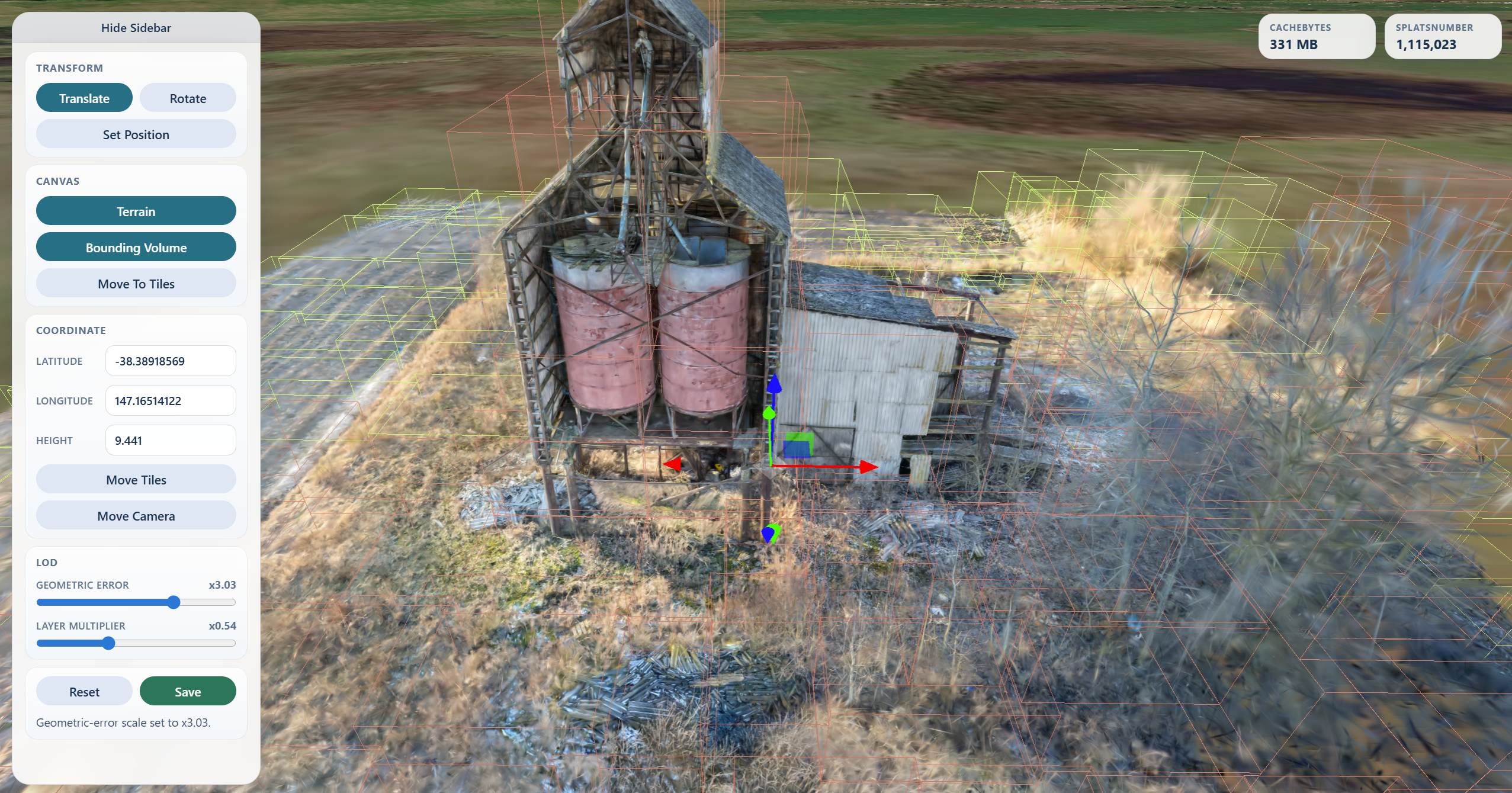
Translate,Rotate, infiniteScaletrack/value input, andResetfor root transform editsMove Camerato a WGS84 latitude / longitude / heightMove Tilesto relocate the tileset root with an ENU-aligned transformSet Positionto click the globe, terrain, or loaded tiles and place the tileset thereTerrain, off by default, to toggle Cesium World Terrain after entering a Cesium ion token, while keeping satellite imageryGeometric Errorscaling from1/16xto16xLayer Multiplierscaling from1/8xto8xfor each tile's geometric-error difference from the tileset's global leaf baselineCrop Regionsfor drawing screen-space exclude regions or a crop sphere on 3D Gaussian Splat tilesetsSaveto persist root transform edits, geometric-error scaling, and confirmed crop selections back to disk
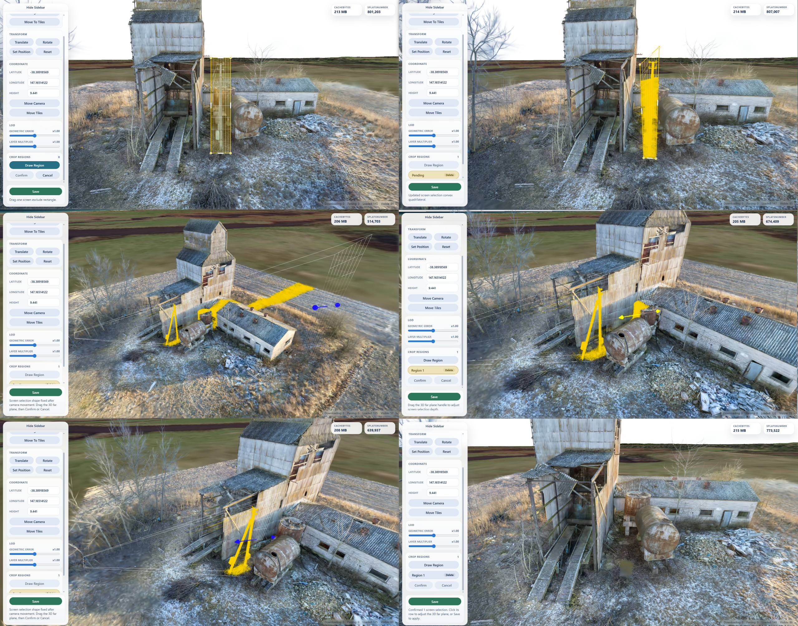
Crop Regions appears when the loaded tileset contains 3D Gaussian Splat content. It lets you draw one or more screen-space exclude rectangles or define a single crop sphere, preview them in the viewer, then apply the crop when you click Save.
For screen regions:
- Click
Draw Regionand drag a rectangle over the splats to remove. - Before moving the camera, drag pending corner points or side handles if the screen region needs adjustment; the pending shape must stay a convex four-sided screen quadrilateral.
- Rotate, pan, or zoom the camera to fix the pending screen shape in 3D, then drag the far-plane handle to set how deep the crop region extends into the scene.
- Click
Confirmto add the region to the save list, orCancelto discard the pending rectangle. - Select a confirmed region row if you need to adjust its 3D far plane with the transform handle.
- Click
Saveto persist the root transform and delete splats inside the confirmed crop regions.
For the crop sphere:
- Click
Create Sphereto place one sphere at the current tileset center. - Adjust its radius with the radius track, or select its row and move it with the sphere-center local-coordinate transform handle.
- Click
Confirmto hide splats outside the sphere, orCancelto discard it. - Click
Saveto remove splats outside the confirmed sphere.
Crop saving rewrites supported local .gltf / .glb Gaussian Splat resources that use KHR_gaussian_splatting_compression_spz_2. Fully deleted splat primitives are removed from their glTF, and empty tile content can be pruned from the tileset JSON. Remote content and unsupported Gaussian Splat encodings are rejected instead of being modified.
If build_summary.json exists next to the root tileset, Save also updates:
root_transformroot_transform_sourceroot_coordinateviewer_geometric_error_scaleviewer_geometric_error_layer_scale
npm install
npm test
npm run pack:checkRuntime and validation failures throw InspectorError from the Node API and print a concise error message in the CLI.